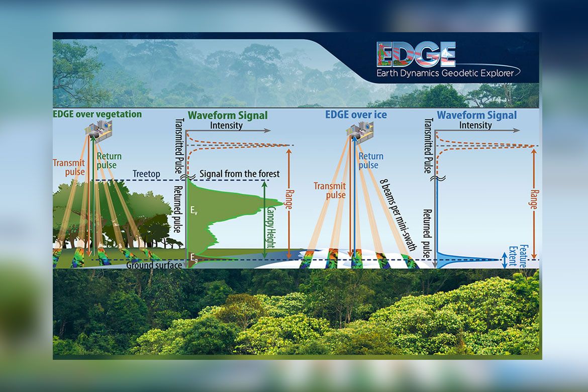
A diagram illustrating how the EDGE (Earth Dynamics Geodetic Explorer) instrument uses laser pulse signals to measure canopy height over vegetation and surface features over ice, with accompanying waveform signal charts.
UCSD/NASA
EDGE’s innovation stems from its “mini-swath” approach. With five full-waveform lasers each split into eight beams, it lays down five 120-meter-wide “mini-swaths” that continuously profile the 3D structure of forests and ice features.